Last updated 30.7.2019
| Date |
The walk starts at 10:30 on the 24 Sep 2019 The Churnet Valley |
|
Walk Info (long walk) |
[023] The Churnet Valley. Hilly and often wooded countryside to the NW of Alton Towers. |
| Distance | 15.5 km |
| Ascents | About 535 m in total. Three short climbs. One steep descent. |
|
Leader (long walk) |
|
|
Walk Info (short walk) |
[023] A good variety of terrain and scenery. Mix of woodlands and livestock farms. |
| Distance | 8.4 km |
| Ascents | Less than 276 m in total. |
|
Leader (short walk) |
|
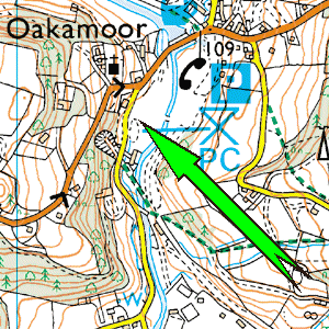
| Start | The car park in Oakamoor. |
| Grid Ref | SK052446 |
| Travel | Follow A50 to B5030 junction.
Follow signed route to Alton Towers.
Just before River Churnet turn left on to "Red Road" and follow to Oakamoor.
Journey time from Loughborough 70min for 42 miles. |
|
Try clicking on the signpost to get a map. Then zoom out for a suitable route-plan map |
 |
| Aerial map of start |
For Google satellite map of the start point, click here. |
| Extra Info | Allow some extra time for possible holdups. Coaches stuck in traffic on winding roads might be encountered. |
| Toilets at start? | Yes. |